Showcase Gallery
Highlight

-
Centamap developed by Centamap Company Limited is one of the pioneering internet map guides in Hong Kong, utilizing official digital maps from the Lands Department.
-
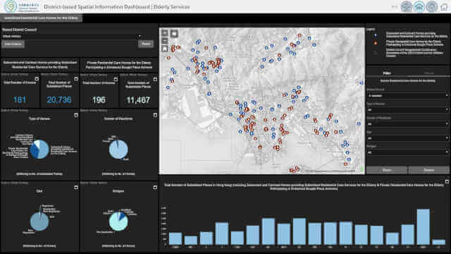
The Social Welfare Department offers a wide range of public services. More than 45 types of social services use the GeoInfo Map to present the locations of service units, covering areas such as Social Security, Family and Child Welfare, Medical Social Services, Rehabilitation Services, Services for Offenders, Youth Welfare Services, and Community Development and Support Services. With detailed information provided on the website and the associated GeoInfo Map, the public can locate the welfare services they need with greater efficiency. Explore the following two examples to learn more.
-
A comprehensive Beach Water Quality Monitoring Programme has been implemented by the Environmental Protection Department to protect public health.
-
The information on major projects on the Civil Engineering and Development Department’s website is presented in a map view.
-
The Agriculture, Fisheries and Conservation Department (AFCD) offers a wide range of facilities within Country Parks to enrich the public’s recreational experience.
-
The “Enjoy Hiking” website promotes hiking in Hong Kong by showcasing various trails and attractions.
-
Developed by the Transport Department, “HKeMobility” is an all-in-one mobile application that allows users to carry out trip planning through conducting point-to-point route search for public transport, driving, and walking. “HKeMobility” also disseminates real-time traffic updates, parking availability, and estimated arrival times of public transport, so users may obtain personalized, accessible, and multi-modal travel information.
-
Promote cycling and cycling safety through the use of spatial data and statistics, and discover the ongoing development of cycling network.